Category:1763 maps of Quebec
Jump to navigation
Jump to search
Provinces and territories of Canada: Quebec ·
| ← 1760 1761 1763 1764 1767 1768 |
English: Maps of Quebec from 1763 or related to Quebec in 1763
Français : Les cartes du Quebec de 1763 ou se rapportant au Quebec en 1763
Media in category "1763 maps of Quebec"
The following 4 files are in this category, out of 4 total.
-
 A new map of the Province of Quebec (7537872682).jpg 2,000 × 1,520; 3.03 MB
-
 A new map of the province of Quebec in North America LOC 2017593665.jpg 4,316 × 3,382; 1.74 MB
-
 A new map of the province of Quebec in North America LOC 2017593665.tif 4,316 × 3,382; 41.76 MB
-
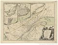 Province de Quebec,1763.jpg 1,380 × 1,054; 328 KB
.jpg)

