Category:1768 maps
Jump to navigation
Jump to search
| ← · 1760 · 1761 · 1762 · 1763 · 1764 · 1765 · 1766 · 1767 · 1768 · 1769 · → |
Deutsch: Karten mit Bezug zum Jahr 1768
English: Maps related to the year 1768
Español: Mapas relativos al año 1768
Français : Cartes concernant l’an 1768
Русский: Карты 1768 года
Subcategories
This category has the following 9 subcategories, out of 9 total.
A
- 1768 maps of Africa (3 F)
- 1768 maps of Asia (3 F)
E
N
O
- 1768 maps of Oceania (2 F)
S
- 1768 maps of South America (11 F)
Media in category "1768 maps"
The following 65 files are in this category, out of 65 total.
-

-

-

-

-
 A map of Canada and the north part of Louisiana with the adjacent countrys. LOC 73695757.jpg 5,399 × 3,460; 2.46 MB
-
 A map of Canada and the north part of Louisiana with the adjacent countrys. LOC 73695758.jpg 9,492 × 4,088; 4.88 MB
-

-

-

-
 A plan of the encampment of the detachment from the little Meadows (18347935635).jpg 1,464 × 2,000; 2.04 MB
-

-
 A plan of the line of march of the detachment from the little Meadows (18347935255).jpg 1,470 × 2,000; 1.99 MB
-
 A plan of the line of march with the whole baggage (18160082048).jpg 1,470 × 2,000; 2.01 MB
-

-
 AMH-8041-KB Map of part of the coast of Venezuela.jpg 2,400 × 1,747; 704 KB
-

-

-
 Carte Bougainville aux Tuamotus 1768.jpg 2,903 × 1,760; 748 KB
-
 Carte Bougainville Tahiti 1768.jpg 4,143 × 3,221; 1.65 MB
-

-

-

-

-

-
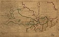
 Carte géometrique du Comté nantois, 1768.jpg 1,000 × 675; 692 KB
-

-

-
 Crown Point & part of Lake Champlain. LOC gm71002320.jpg 11,312 × 4,765; 5.62 MB
-
 Crown Point & part of Lake Champlain. LOC gm71002320.tif 11,312 × 4,765; 154.21 MB
-
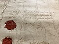 Ferraris signature.jpg 4,032 × 3,024; 3.14 MB
-
 Fort Le Quesne.jpg 964 × 1,028; 143 KB
-
 Franklin-Folger chart of the Gulf Stream. LOC 88696412.jpg 9,644 × 8,605; 13.68 MB
-
 Franklin-Folger chart of the Gulf Stream. LOC 88696412.tif 9,644 × 8,605; 237.43 MB
-

-
 Guadaloupe one of the Caribbee Islands subject to France in the West Indies, LOC 75693285.tif 4,708 × 4,565; 61.49 MB
-

-
 Guadaloupe one of the Caribbee Islands subject to France in the West Indies, LOC 75693286.tif 4,696 × 4,495; 60.39 MB
-
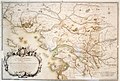
 Laurent, Carte des isles Kouriles (FL147394459 2608023).jpg 8,199 × 6,614; 56.85 MB
-
 Mapa de Malvinas, Felipe Ruiz Puente, 1768.jpg 3,603 × 2,680; 1.02 MB
-

-
 Offleben 1768.png 667 × 918; 1.06 MB
-

-
 Païs cedés, sheet Ist, containing the coast of Louisiana and Florida (18162564399).jpg 2,000 × 1,462; 2.13 MB
-

-

-
 Plan de la ville des Cayes, dans l'Isle Saint Domingue. LOC 74691151.jpg 7,579 × 10,606; 13.88 MB
-
 Plan de la ville des Cayes, dans l'Isle Saint Domingue. LOC 74691151.tif 7,579 × 10,606; 229.98 MB
-
 Plan de puerto de Mariel LOC 74690591.jpg 4,152 × 5,495; 2.81 MB
-
 Plan de puerto de Mariel LOC 74690591.tif 4,152 × 5,495; 65.28 MB
-
 Plan of Bahía Honda. Plan of Puerto de Cavañas. LOC 73697707.jpg 5,324 × 8,557; 5.51 MB
-
 Plan of Bahía Honda. Plan of Puerto de Cavañas. LOC 73697707.tif 5,324 × 8,557; 130.34 MB
-

-

-
 Plan of the city and harbour of the Havana. Plan of Bahía de Matanzas. LOC 74690536.jpg 5,769 × 8,634; 6.53 MB
-
 Plan of the city and harbour of the Havana. Plan of Bahía de Matanzas. LOC 74690536.tif 5,769 × 8,634; 142.51 MB
-
 Plan of the town and harbour of San Juan de Puerto Rico LOC 74690592.jpg 4,202 × 6,286; 3.07 MB
-
 Plan of the town and harbour of San Juan de Puerto Rico LOC 74690592.tif 4,202 × 6,286; 75.57 MB
-
 Plano del puerto y río de Guayaquil LOC 90682853.jpg 4,935 × 3,461; 2.41 MB
-
 Plano del puerto y río de Guayaquil LOC 90682853.tif 4,935 × 3,461; 48.87 MB
-
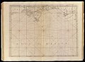
 Sjøkart over Nordsjøen, mellom Skottland, Dannmark, Norge og Island, fra 1768.png 4,289 × 2,901; 27.08 MB
-
 The grand bay of Nipe on the north side of Cuba from Spanish draughts. LOC 73697705.jpg 4,989 × 8,329; 5.23 MB
-
 The grand bay of Nipe on the north side of Cuba from Spanish draughts. LOC 73697705.tif 4,989 × 8,329; 118.89 MB
-

-

-


.jpg)
.jpg)
.jpg)
.jpg)
.jpg)
.jpg)
.jpg)
.jpg)

.jpg)


.jpg)

.jpg)

.jpg)
.jpg)


.jpg)
.jpg)


