Category:1770s maps of North Carolina
Jump to navigation
Jump to search
States of the United States: Alabama · Alaska · California · Connecticut · Delaware · Florida · Georgia · Illinois · Indiana · Kentucky · Louisiana · Maine · Maryland · Massachusetts · Mississippi · Missouri · New Hampshire · New Jersey · New York · North Carolina · Ohio · Pennsylvania · Rhode Island · South Carolina · Tennessee · Vermont · Virginia
Puerto Rico
Puerto Rico
Subcategories
This category has the following 3 subcategories, out of 3 total.
Media in category "1770s maps of North Carolina"
The following 9 files are in this category, out of 9 total.
-
 1775 Watauga Grant.png 1,684 × 1,013; 930 KB
-

-

-
 A compleat Map of North Carolina from an actual survey - by Captn Collet... - btv1b53029818z.jpg 14,036 × 9,714; 22.69 MB
-

-
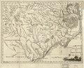 A new and accurate map of North Carolina in North America. LOC 2013593295.tif 4,328 × 3,550; 43.96 MB
-

-
 A plan of Cape Fear River, from the Bar to Brunswick - btv1b53089807z (1 of 2).jpg 6,772 × 9,079; 7.77 MB
-
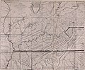 The Wilderness road to Kentucky, its location and features (1921) (14783613363).jpg 1,992 × 1,642; 560 KB


.jpg)


.jpg)
_(14783613363).jpg)