Category:1770s maps of South America
Jump to navigation
Jump to search
Temperate regions: North America · South America · Africa · Europe · Asia · Oceania – Polar regions: – Other regions:
 18th-century maps of South America: ← 1700s 1710s 1720s 1730s 1740s 1750s 1760s 1770s 1780s 1790s → 18th-century maps of South America: ← 1700s 1710s 1720s 1730s 1740s 1750s 1760s 1770s 1780s 1790s →
|
Subcategories
This category has the following 19 subcategories, out of 19 total.
- 1770 maps of South America (5 F)
- 1771 maps of South America (4 F)
- 1772 maps of South America (8 F)
- 1775 maps of South America (14 F)
- 1776 maps of South America (3 F)
- 1777 maps of South America (2 F)
- 1778 maps of South America (4 F)
- 1779 maps of South America (4 F)
A
- 1770s maps of Argentina (6 F)
B
- 1770s maps of Bolivia (1 F)
- 1770s maps of Brazil (3 F)
C
- 1770s maps of Chile (12 F)
- 1770s maps of Colombia (1 F)
E
- 1770s maps of Ecuador (1 F)
P
- 1770s maps of Paraguay (2 F)
- 1770s maps of Peru (3 F)
U
- 1770s maps of Uruguay (2 F)
V
- 1770s maps of Venezuela (5 F)
Media in category "1770s maps of South America"
The following 2 files are in this category, out of 2 total.
-
 America Coleti.jpg 1,242 × 1,080; 1.13 MB
-
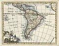 28 América del Sur.jpg 837 × 653; 146 KB

