Category:1780s maps of Vermont
Jump to navigation
Jump to search
States of the United States: Alabama · Alaska · Arkansas · California · Connecticut · Delaware · Florida · Georgia · Illinois · Indiana · Kentucky · Louisiana · Maryland · Massachusetts · Michigan · Mississippi · Missouri · Montana · New Hampshire · New Jersey · New York · North Carolina · North Dakota · Ohio · Pennsylvania · Rhode Island · South Carolina · Vermont · Virginia · Wisconsin – Washington, D.C.
Puerto Rico
Puerto Rico
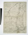
Media in category "1780s maps of Vermont"
The following 4 files are in this category, out of 4 total.
-
 1780 map of the Hubbardton Military Road.jpg 808 × 714; 442 KB
-

-
-
 Rigobert-Bonne-Atlas-de-toutes-les-parties-connues-du-globe-terrestre MG 0026.tif 5,251 × 3,605; 54.19 MB

