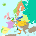
Category:1789 maps of Europe
Jump to navigation
Jump to search
Temperate regions: North America · South America · Africa · Europe · Asia · – Polar regions: – Other regions:
English: 1789 maps of Europe
Español: Mapas de Europa en 1789
Suomi: Euroopan kartat vuodelta 1789
Română: Hărți ale Europei din 1789
Subcategories
This category has the following 6 subcategories, out of 6 total.
Media in category "1789 maps of Europe"
The following 6 files are in this category, out of 6 total.
-
1789 - Neueste Karte Von Der Moldau, Walachei, Bessarabien Und Der Krim.jpg 6,022 × 5,550; 10.81 MB
-
Europa 1789-es.svg 1,357 × 1,357; 1,003 KB
-
Europa 1789.svg 1,357 × 1,357; 674 KB
-
Jean-Claude Dezauche - Map of Europe - Google Art Project.jpg 4,001 × 3,296; 5.31 MB
-
Sjøkart over den sørvestlige delen av Østersjøen, fra 1789.png 4,254 × 2,915; 27.51 MB
-
Wallachia 1789.jpg 1,974 × 1,316; 738 KB


