Category:1790s maps of Alaska
Jump to navigation
Jump to search
States of the United States: Alaska · Connecticut · Delaware · Florida · Georgia · Indiana · Kentucky · Louisiana · Maryland · Massachusetts · Missouri · New Hampshire · New Jersey · New York · North Carolina · Ohio · Pennsylvania · South Carolina · Tennessee · Vermont – Washington, D.C.
Puerto Rico
Puerto Rico
Media in category "1790s maps of Alaska"
The following 4 files are in this category, out of 4 total.
-
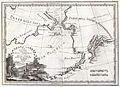
 Карта Шелехова странствования (1791).jpg 1,717 × 945; 1.42 MB
-
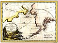
 1798 Cassini Map of Alaska and the Bering Strait - Geographicus - Alaska-cassini-1798.jpg 4,000 × 2,897; 3.09 MB
-
 Le coste nord ovest dell' America e nord est dell' Asia.jpg 3,869 × 2,866; 6.8 MB
-
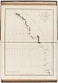 Voyage de La Pérouse autour du monde (No. 16) BHL15849654.jpg 6,832 × 9,696; 3.69 MB
.jpg)


_BHL15849654.jpg)