Category:1790s maps of Germany
Jump to navigation
Jump to search
Federal states of Germany:
Subcategories
This category has the following 24 subcategories, out of 24 total.
B
- 1790s maps of Bavaria (7 F)
H
L
M
N
R
S
- 1790s maps of Saarland (5 F)
T
- 1790s maps of Thuringia (66 F)
Media in category "1790s maps of Germany"
The following 7 files are in this category, out of 7 total.
-
 1799 Cary Map of the Upper and Lower Rhine - Geographicus - Rhine-cary-1799.jpg 5,000 × 4,458; 8.23 MB
-

-
 Map of Germany and Switzerland in 1791 by Reilly 092.jpg 1,137 × 1,056; 532 KB
-
 Map of Germany and Switzerland in 1791 by Reilly 092b.jpg 643 × 568; 144 KB
-
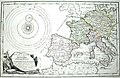 Map of Western Europe in 1791 by Reilly 0006.jpg 1,470 × 952; 591 KB
-
 Map of Western Europe in 1791 by Reilly 0006b.jpg 1,346 × 888; 531 KB
-
 Reilly Allgemeiner Postatlas Deutschland.jpg 500 × 332; 30 KB


