Category:1796 maps of New York (state)
Jump to navigation
Jump to search
Media in category "1796 maps of New York (state)"
The following 12 files are in this category, out of 12 total.
-

-
 Albert Capsouto Park td (2018-11-07) 03.jpg 3,648 × 5,472; 7.47 MB
-
 Map of the state of New York LOC 2018590095.jpg 3,236 × 2,577; 963 KB
-
 Map of the state of New York LOC 2018590095.tif 3,236 × 2,577; 23.86 MB
-
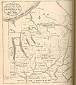
 Newyork1796.GIF 846 × 603; 12 KB
-
 NY-1796map.jpg 710 × 794; 169 KB
-
 The state of New York LOC 2018590096.jpg 6,102 × 5,145; 3.88 MB
-
 The state of New York LOC 2018590096.tif 6,102 × 5,145; 89.82 MB
-
 The state of New York LOC 2018590097.jpg 5,695 × 4,803; 3.49 MB
-
 The state of New York LOC 2018590097.tif 5,695 × 4,803; 78.26 MB
-
 The state of New York, compiled from the most authentic information, 1796. NYPL1253205.tiff 5,062 × 4,550; 65.9 MB
-
 The state of New York, compiled from the most authentic information, 1796. NYPL484183.tiff 4,991 × 4,596; 65.63 MB

_03.jpg)


