Category:1799 maps of Africa
Jump to navigation
Jump to search
Temperate regions: North America · South America · Africa · Europe · Asia · – Polar regions: – Other regions:
| ← 1790 1791 1792 1793 1794 1795 1796 1797 1798 1799 → |
Media in category "1799 maps of Africa"
The following 8 files are in this category, out of 8 total.
-

-
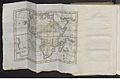
 1799 Clement Cruttwell Map of Africa - Geographicus - Africa-cruttwell-1799.jpg 3,500 × 3,041; 2.64 MB
-

-
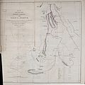 Map of the route of the Soudan Caravan from Assiut to Darfur.jpg 3,342 × 3,354; 3.53 MB
-
 Nouvel atlas des enfans - 1799 - UB Radboud Uni Nijmegen - 028718437 Map 21.jpeg 1,228 × 810; 256 KB
-
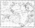 Rennel map 1799.png 1,318 × 1,060; 335 KB
-
 William Henry Toms, Africa Interior (FL13723578 2493223).jpg 6,048 × 4,096; 31.61 MB
-
 William Henry Toms, Africa Propria (FL13727044 2496883).jpg 5,992 × 3,960; 34.75 MB


.jpg)
.jpg)