Category:17th-century maps of Borneo
Jump to navigation
Jump to search
Media in category "17th-century maps of Borneo"
The following 12 files are in this category, out of 12 total.
-
 B26056123C - Borneo Insula.jpg 5,266 × 3,779; 6.61 MB
-
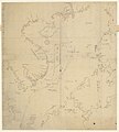
 Kaart van het eiland Borneo, 1601 Borneo Insula (titel op object), RP-P-OB-75.413.jpg 6,088 × 4,624; 5.26 MB
-

-
-
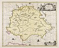 Insula Borneo et occidentalis pars Celebis cum adjacentibus insulis - CBT 6618604.jpg 5,888 × 4,749; 6.29 MB
-

-

-
 India quae Orientalis dicitur et insulae adiacentes - btv1b525051494 (2 of 4).jpg 9,744 × 7,897; 8.41 MB
-
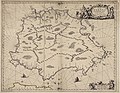
 Insula Borneo et occidentalis pars Celebis cum adjacentibus Insulis - btv1b10101769f.jpg 9,777 × 7,475; 7.23 MB
-
 Insula Borneo et occidentalis pars Celebis cum adjacentibus insulis - btv1b59632992.jpg 6,432 × 5,224; 5.27 MB
-
 Insula Borneo et occidentalis pars Celebis cum adjacentibus Insulis - btv1b8459044d.jpg 8,731 × 6,799; 8.79 MB
-
 Insula Borneo et occidentalis pars Celebis cum adjacentibus insulis - btv1b84930860.jpg 8,496 × 6,891; 8.27 MB

,_RP-P-OB-75.413.jpg)
.jpg)


,_NG-501-84.jpg)
,_RP-P-OB-75.411.jpg)
.jpg)


