Category:17th-century maps of Florida
Jump to navigation
Jump to search
States of the United States: Alaska · California · Connecticut · Delaware · Florida · Georgia · Illinois · Louisiana · Maine · Maryland · Massachusetts · New Hampshire · New Jersey · New Mexico · New York · North Carolina · Oregon · Pennsylvania · Rhode Island · South Carolina · Texas · Virginia
Puerto Rico
Puerto Rico
Subcategories
This category has the following 5 subcategories, out of 5 total.
- 1630s maps of Florida (2 F)
- 1650s maps of Florida (1 F)
- 1670s maps of Florida (4 F)
- 1680s maps of Florida (empty)
M
Media in category "17th-century maps of Florida"
The following 5 files are in this category, out of 5 total.
-

-

-

-
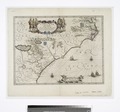
 Map of Atlantic Coast of North America from the Chesapeake Bay to Florida WDL10081.png 1,429 × 1,024; 2.98 MB
-
_regionum_nova_descriptio_(4583422389).jpg)

,_NG-501-91.jpg)
