Category:17th-century maps of the Persian Gulf
Jump to navigation
Jump to search
Subcategories
This category has only the following subcategory.
M
Media in category "17th-century maps of the Persian Gulf"
The following 14 files are in this category, out of 14 total.
-
 Map of ancient Persia (1600) a closer view.jpg 800 × 1,067; 208 KB
-
 Map of Asia (1600) Persian Gulf.jpg 800 × 600; 141 KB
-
 Sinus Arabicus 1600.png 2,880 × 2,880; 7.76 MB
-
 Sinus Arabicus.jpg 719 × 719; 580 KB
-
 Elcatif.jpg 711 × 500; 127 KB
-
 Arabian Gulfe.jpg 719 × 719; 550 KB
-
 SinusArabicus.jpg 1,928 × 1,920; 2.61 MB
-
-

-
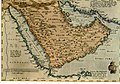
 Arabia WDL2919.png 1,202 × 1,024; 2 MB
-
 Travels of Pietro della Valle-1.png 1,752 × 1,231; 857 KB
-
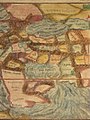
 Accuratissima et Maxima Totius Turcici Imperii Tabula (cropped).jpg 1,663 × 1,252; 816 KB
-
 Accuratissima et Maxima Totius Turcici Imperii Tabula.jpg 8,820 × 7,380; 8.33 MB
-
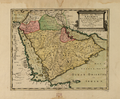
 PG Jansson.jpg 485 × 327; 53 KB
_a_closer_view.jpg)
_Persian_Gulf.jpg)


.jpg)

