Category:1800s maps of New Hampshire
Jump to navigation
Jump to search
States of the United States: Alabama · Alaska · Connecticut · Delaware · Florida · Georgia · Illinois · Indiana · Kentucky · Louisiana · Maine · Maryland · Massachusetts · Michigan · Minnesota · Mississippi · Missouri · New Hampshire · New Jersey · New York · North Carolina · Ohio · Pennsylvania · Rhode Island · South Carolina · Tennessee · Vermont · Virginia – Washington, D.C.
Puerto Rico
Puerto Rico
Media in category "1800s maps of New Hampshire"
The following 4 files are in this category, out of 4 total.
-
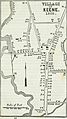
 97 of '(Annals of the town of Keene.)' (11036548966).jpg 1,437 × 2,426; 573 KB
-
-

-

%27_(11036548966).jpg)
_(14783337943).jpg)
.jpg)
.jpg)