Category:1810s maps of Romania
Jump to navigation
Jump to search
Countries of Europe: Albania · Armenia‡ · Austria · Azerbaijan‡ · Belgium · Bosnia and Herzegovina · Bulgaria · Croatia · Cyprus‡ · Czech Republic · Denmark · Finland · France‡ · Georgia‡ · Germany · Greece · Hungary · Republic of Ireland · Italy · Lithuania · Netherlands‡ · Norway · Poland · Portugal‡ · Romania · Russia‡ · Slovakia · Slovenia · Spain‡ · Sweden · Turkey‡ · Ukraine · United Kingdom
Limited recognition: Abkhazia‡
‡: partly located in Europe
Limited recognition: Abkhazia‡
‡: partly located in Europe
Media in category "1810s maps of Romania"
The following 11 files are in this category, out of 11 total.
-
-
 MOLDNAPOL.jpg 3,120 × 2,256; 3.31 MB
-
 Tarile romanesti la 1812.jpg 584 × 483; 144 KB
-
 KKR-25 Carte générale de la Turquie d'Europe de la Grece et des iles Joniennas.jpg 1,316 × 1,721; 329 KB
-
 Map of Romania by Daniel Philippidis.png 1,162 × 919; 2.28 MB
-
 Подробная карта Российской империи и близлежащих заграничных владений — лист 011.jpg 4,872 × 4,463; 10.78 MB
-
 Подробная карта Российской империи и близлежащих заграничных владений — лист 012.jpg 4,892 × 4,488; 11.74 MB
-
 Подробная карта Российской империи и близлежащих заграничных владений — лист 030.jpg 4,887 × 4,478; 8.05 MB
-
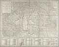
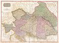 1818 Pinkerton Map of the Austrian Empire - Geographicus - Austria-pinkerton-1818.jpg 5,000 × 3,642; 5.51 MB
-

-


.jpg)
.jpg)