Category:1813 maps of Ohio
Jump to navigation
Jump to search
Media in category "1813 maps of Ohio"
The following 4 files are in this category, out of 4 total.
-
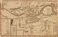
 1813 Map of the Rapids of Miami, showing Fort Meigs.jpg 1,397 × 930; 193 KB
-

-

-
 Plan of Fort Meigs' and its environs by Sebree, 1813.jpg 11,441 × 7,260; 26.93 MB

_the_operations_of_the_American_forces,_under_Genl._W.H._Harrison,_and_the_British_Army_and_their_allies,_under_Genl._Proctor_and_Tecumseh_LOC_2004625488.jpg)
