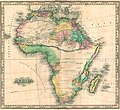
Category:1820s maps of Africa
Jump to navigation
Jump to search
Temperate regions: North America · South America · Africa · Europe · Asia · Oceania – Polar regions: – Other regions:
Subcategories
This category has the following 18 subcategories, out of 18 total.
- 1820 maps of Africa (20 F)
- 1821 maps of Africa (10 F)
- 1822 maps of Africa (6 F)
- 1823 maps of Africa (4 F)
- 1824 maps of Africa (8 F)
- 1825 maps of Africa (7 F)
- 1826 maps of Africa (12 F)
- 1827 maps of Africa (12 F)
- 1828 maps of Africa (8 F)
- 1829 maps of Africa (11 F)
A
- 1820s maps of Algeria (4 F)
E
- 1820s maps of Egypt (19 F)
- 1820s maps of Ethiopia (1 F)
L
- 1820s maps of Libya (2 F)
M
- 1820s maps of Mauritania (1 F)
- 1820s maps of Morocco (1 F)
S
- 1820s maps of Sudan (2 F)
T
- 1820s maps of Tunisia (4 F)
Media in category "1820s maps of Africa"
This category contains only the following file.
-
Africa - DPLA - 7239e5426c3a274a12f9e7ac5e8137eb.jpg 1,000 × 918; 284 KB
