Category:1826 Map of the country between Washington & Pittsburg refering to the contemplated Chesapeake & Ohio Canal
Jump to navigation
Jump to search
Media in category "1826 Map of the country between Washington & Pittsburg refering to the contemplated Chesapeake & Ohio Canal"
The following 5 files are in this category, out of 5 total.
-

-
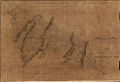 Map from 1826 of proposed Chesapeake and Ohio Canal Route.jpg 1,000 × 686; 672 KB
-

-

-


.jpg)