Category:1830s maps of Chechnya
Jump to navigation
Jump to search
Federal subjects of the Russian Federation:
Republics: Chechnya · Dagestan ·Krais:
Oblasts:
Federal cities:
Autonomous oblast:
Autonomous okrugs:
Media in category "1830s maps of Chechnya"
The following 8 files are in this category, out of 8 total.
-
-
 Кисти.jpg 1,080 × 1,092; 247 KB
-
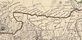
 Карта Чечни 1838 год (файл 1).jpg 960 × 960; 221 KB
-
 22365CAA-5BAD-4D93-8D32-61CF.jpg 1,280 × 720; 101 KB
-

-

-
 Карта Чечни 1838 год (файл 2).jpg 960 × 818; 167 KB
-
 Карта Чечни, автор Берже А. П.jpg 2,500 × 2,273; 1,005 KB
._Russia_in_Europe_Part_IX_and_Georgia.1835.BE.jpg)

.jpg)

.jpg)

.jpg)
