Category:1832 maps of Massachusetts
Jump to navigation
Jump to search
States of the United States: Massachusetts
| ← 1831 1832 1833 1834 1835 1836 1837 1838 1839 → |
Media in category "1832 maps of Massachusetts"
The following 10 files are in this category, out of 10 total.
-
 1832 ElmSt map Boston Stimpson BPL10944.png 799 × 713; 1,002 KB
-
-
 A map of the town of Holden LOC 2015588525.jpg 6,106 × 8,234; 5.07 MB
-
 A map of the town of Holden LOC 2015588525.tif 6,106 × 8,234; 143.84 MB
-
 Map of the town of Danvers (3370515226).jpg 1,501 × 2,000; 2.44 MB
-
 Geological map of Massachusetts (2674139357).jpg 2,000 × 1,315; 2.25 MB
-
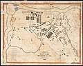
 Map of the town of Roxbury (2674665153).jpg 2,000 × 1,597; 2.09 MB
-
 Map of Wareham. LOC 76692180.jpg 7,311 × 6,443; 7.11 MB
-
 Map of Wareham. LOC 76692180.tif 7,311 × 6,443; 134.77 MB
-
 Plan of the city of Boston (2674425595).jpg 2,000 × 1,309; 2.34 MB


.jpg)
.jpg)
.jpg)

.jpg)