Category:1850s maps of Bolivia
Jump to navigation
Jump to search
Subcategories
This category has the following 2 subcategories, out of 2 total.
M
Media in category "1850s maps of Bolivia"
The following 7 files are in this category, out of 7 total.
-
 1850 Mitchell Map of Peru and Bolivia - Geographicus - PeruBolivia-mitchell-1850.jpg 3,500 × 2,904; 3.55 MB
-
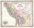 1855 Colton Map of Peru and Bolivia - Geographicus - PeruBolivia-colton-1855.jpg 4,000 × 3,255; 3.66 MB
-
 Colton’s Peru and Bolivia WDL11317.png 1,170 × 1,024; 2.44 MB
-

-

-
 Mapa de la República de Bolivia, 1859.jpg 4,639 × 5,755; 5.03 MB
-
 Meyer‘s Zeitungsatlas 081 – Südlichster Theil von America.jpg 7,379 × 6,224; 12.88 MB


.jpg)
.jpg)

