Category:1850s maps of Syria
Jump to navigation
Jump to search
Countries of Asia: Afghanistan · Armenia‡ · Azerbaijan‡ · People's Republic of China · Cyprus‡ · Egypt‡ · Georgia‡ · India · Indonesia‡ · Iran · Iraq · Japan · Jordan · Lebanon · Pakistan · Philippines · Russia‡ · Syria · Turkey‡
Limited recognition: Abkhazia‡ · Taiwan · State of Palestine
‡: partly located in Asia
Limited recognition: Abkhazia‡ · Taiwan · State of Palestine
‡: partly located in Asia
Media in category "1850s maps of Syria"
The following 15 files are in this category, out of 15 total.
-
 184 of '(Sinai and Palestine, in connection with their history.)' (11047780294).jpg 1,409 × 2,377; 477 KB
-
 184 of '(Sinai and Palestine, in connection with their history.)' (11048562505).jpg 1,391 × 2,360; 460 KB
-
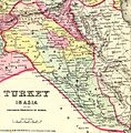
 1850 Mitchell - Mitchell Map of Turkey in Asia - Geographicus - TurkeyAsia-m-50.jpg 4,000 × 3,278; 3.18 MB
-
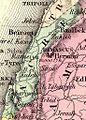
 1851 Henry Warren Map of Syria (cropped).jpg 3,162 × 4,413; 12.73 MB
-
 1851 Henry Warren Map of Syria.jpg 3,750 × 4,700; 15.66 MB
-

-
 180 of 'Sinai and Palestine, in connection with their history' (11047655935).jpg 1,434 × 2,342; 450 KB
-

-
-
 Colton, G.W. Turkey In Asia And The Caucasian Provinces Of Russia. 1856 (FD).jpg 1,166 × 1,171; 384 KB
-

-
 Colton, G.W. Turkey In Asia And The Caucasian Provinces Of Russia. 1856 (G).jpg 2,118 × 2,146; 1.33 MB
-
-
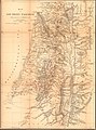 KiepertSouthernPalestine1856.jpg 4,522 × 6,119; 12.29 MB
-
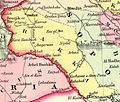
 Lots d465 mid 19th century map of asia minor and syria.jpg 2,400 × 3,646; 1.13 MB
%27_(11047780294).jpg)
%27_(11048562505).jpg)

.jpg)

.jpg)
.jpg)
.jpg)
.jpg)
.jpg)
.jpg)
.jpg)
.jpg)

