Category:1853 maps of Canada
Jump to navigation
Jump to search
Countries of North America: Canada · Mexico · United States of America‡
‡: partly located in North America
‡: partly located in North America
| 1850 1851 1852 1853 1854 1855 1856 1857 1858 1859 → |
English: Maps of Canada from 1853 or related to Canada in 1853
Français : Les cartes du Canada de 1853 ou se rapportant au Canada en 1853
Media in category "1853 maps of Canada"
The following 2 files are in this category, out of 2 total.
-

-
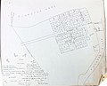 Map of the Village of Pembroke, 1853.jpg 3,079 × 2,498; 2.6 MB

