Category:1853 maps of Russia
Jump to navigation
Jump to search
Subcategories
This category has the following 2 subcategories, out of 2 total.
M
- Khotev Atlas of Moscow (98 F)
S
Media in category "1853 maps of Russia"
The following 12 files are in this category, out of 12 total.
-
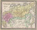
 1853 Mitchell Map of Russia - Geographicus - Russia-mitchell-1853.jpg 2,521 × 3,000; 2.45 MB
-
-
-
-
 Admiralty Chart No 2216 Kronstat From The Russian Survey, Published 1853.jpg 2,821 × 2,100; 914 KB
-
 Borodyno lexicon 1853.jpg 8,196 × 6,019; 30.51 MB
-
 Kalazin 20p-cr.jpg 945 × 1,575; 343 KB
-
 Plan SPb 1853.jpg 351 × 400; 34 KB
-
 Rgev 20p cr.jpg 2,716 × 2,562; 1.48 MB
-
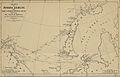
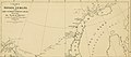
 Survey of the Sea of Aral 1853.jpg 934 × 1,560; 371 KB
-
 Zubcov 20p cr.jpg 2,275 × 1,214; 646 KB
-
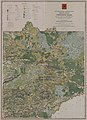 Карта Тверского уезда Тверской губернии изданная в 1853г..jpg 1,081 × 1,494; 408 KB


_(14591460908).jpg)
_(14778110055).jpg)


