Category:1860s maps of Eastern Europe
Jump to navigation
Jump to search
| 19th-century maps of Eastern Europe: ← 1800s 1810s 1820s 1830s 1840s 1850s 1860s 1870s 1880s 1890s → |
Media in category "1860s maps of Eastern Europe"
The following 17 files are in this category, out of 17 total.
-
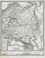
 1860. Russia in Europe, Sweden, and Norway.tif 6,299 × 5,248, 7 pages; 98.24 MB
-
 1860. Генеральная политическая карта Европейской России.jpg 26,750 × 34,000; 63.8 MB
-
 CHODZKO(1861) CARTE DES PAYS SLAVO-POLONAIS AUX VIII ET IX SIECLE.jpg 5,201 × 3,892; 5.45 MB
-
 CHODZKO(1861) CARTE DES ÉTATS DE LA REPUBLIQUE DE POLOGNE AUX XVI ET XVII SIECLES.jpg 3,167 × 3,953; 3.85 MB
-
 1861 р.. Ходзько Борейко Леонард Стан на 862 р.jpg 1,600 × 1,198; 553 KB
-
 1862 Johnson Map of Russia - Geographicus - Russia-johnson-1862.jpg 3,224 × 4,000; 3.43 MB
-
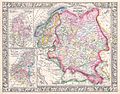
 1862 Perthes Map of Russia - Geographicus - Russland-perthes-1862.jpg 2,551 × 3,299; 2.6 MB
-
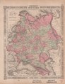
 1862 Stieler Map of Northern Germany - Geographicus - StaatenDeutschen-perthes-1862.jpg 3,132 × 2,600; 1.57 MB
-
 1862 Stieler Map of Poland and Hungary - Geographicus - Polen-perthes-1862.jpg 2,844 × 2,551; 1.97 MB
-

-

-
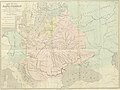
 Ethnic composition of the westernmost parts of the Russian Empire, Erckert, 1863.jpg 2,048 × 1,695; 1.27 MB
-
 Etnograficheskiy atlas Zapadno Russkih gubernij, 1863.jpg 3,624 × 3,000; 4.85 MB
-
 Johnson's map of Russia in 1863.tif 8,308 × 10,808; 185.97 MB
-
 Tableau Ethnographique (Georg Ferdinand Robert d'Erckert, 1863).jpg 9,049 × 7,321; 8.75 MB
-
-


_CARTE_DES_PAYS_SLAVO-POLONAIS_AUX_VIII_ET_IX_SIECLE.jpg)
_CARTE_DES_%C3%89TATS_DE_LA_REPUBLIQUE_DE_POLOGNE_AUX_XVI_ET_XVII_SIECLES.jpg)


.jpg)
.jpg)


.jpg)
