Category:1860s maps of Finland
Jump to navigation
Jump to search
Countries of Europe: Armenia‡ · Austria · Azerbaijan‡ · Belgium · Bosnia and Herzegovina · Bulgaria · Croatia · Cyprus‡ · Czech Republic · Denmark · Finland · France‡ · Georgia‡ · Germany · Greece · Hungary · Iceland · Republic of Ireland · Italy · Latvia · Lithuania · Luxembourg · Netherlands‡ · Norway · Poland · Portugal‡ · Romania · Russia‡ · Serbia · Slovenia · Spain‡ · Sweden · Switzerland · Turkey‡ · Ukraine · United Kingdom
Limited recognition: Abkhazia‡
‡: partly located in Europe
Limited recognition: Abkhazia‡
‡: partly located in Europe
Media in category "1860s maps of Finland"
The following 8 files are in this category, out of 8 total.
-
 1860. Карта Великого Княжества Финляндского (этногр).jpg 26,750 × 34,000; 55.31 MB
-
 1860. Карта Великого Княжества Финляндского.jpg 26,750 × 34,000; 57.12 MB
-

-

-
 6678524 Suomen yleiskartta, 1864, karttalehti F4.jpg 5,264 × 6,352; 6.53 MB
-
 Hasselbacka Laga Skifte 1866.JPG 1,595 × 845; 188 KB
-
 Karta öfver Helsingfors 1860.jpeg 5,384 × 5,160; 3.58 MB
-
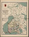 Карта Великого княжества Финляндского.jpg 1,611 × 2,048; 867 KB
.jpg)

.jpg)
.jpg)


