Category:1860s maps of Scotland
Jump to navigation
Jump to search
Media in category "1860s maps of Scotland"
The following 14 files are in this category, out of 14 total.
-

-

-
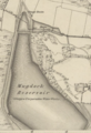 1860 Mugdock Reservoir Map.png 375 × 550; 317 KB
-
 JOHNSTON'S ROYAL ATLAS (1861), SCOTLAND NORTHERN PART.jpg 8,762 × 6,890; 10.45 MB
-
 JOHNSTON'S ROYAL ATLAS (1861), SCOTLAND SOUTHERN PART.jpg 8,702 × 6,834; 11.54 MB
-
 1861 ROSS & CROMARTY SHIRES.jpg 2,350 × 1,618; 1.59 MB
-
 1862 Johnson Map of Scotland and Ireland - Geographicus - SctIre-johnson-1862.jpg 4,000 × 2,627; 3.49 MB
-

-

-

-

-
 A geography for beginners - DPLA - 25f2e74de5ecf0e41a5329ccbf9af71f (page 80).jpg 2,772 × 2,246; 992 KB
-

-
 OS old series Scotland 1 63360 31 (cropped).jpg 1,944 × 1,522; 743 KB
%27_(11071473116).jpg)
%27_(11087809054).jpg)

,_SCOTLAND_NORTHERN_PART.jpg)
,_SCOTLAND_SOUTHERN_PART.jpg)


_Compiled_..._by_..._H._C._Otter._(Revised_by_G._F._McDougall.)_(Pt._2._Compiled_..._by_..._G._F._McDougall.)%27_(11081962016).jpg)
%27_(11085361334).jpg)
.jpg)
%27_(11084594954).jpg)
.jpg)
;_Ireland_in_provinces_and_counties_(NYPL_b13663520-1510831).jpg)
.jpg)