Category:1860s maps of Venezuela
Jump to navigation
Jump to search
Countries of the Americas: Argentina · The Bahamas · Belize · Bolivia · Brazil · Canada · Chile · Colombia · Costa Rica · Cuba · Ecuador · Guatemala · Jamaica · Mexico · Panama · Paraguay · Peru · Saint Vincent and the Grenadines · United States of America · Uruguay · Venezuela
Other areas: Puerto Rico
Other areas: Puerto Rico
Media in category "1860s maps of Venezuela"
The following 5 files are in this category, out of 5 total.
-

-

-
 Map of the republics of northern South America (1860).jpg 3,177 × 2,096; 2.63 MB
-
 Mapa de la Confederación Granadina (1860).jpg 1,200 × 846; 662 KB
-
 Nouvelle Grenade, Venezuela, Equateur et Guyanes 1862.jpg 3,835 × 3,030; 2.16 MB

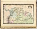
,_Argentina,_Columbia_and_Venezuela_-_Geographicus_-_SouthAmericaNorth-mitchell-1864.jpg)
.jpg)
.jpg)
