Category:1864 maps of Europe
Jump to navigation
Jump to search
Temperate regions: North America · South America · Africa · Europe · Asia · – Polar regions: – Other regions:
English: 1864 maps of Europe
Español: Mapas de Europa en 1864
Suomi: Euroopan kartat vuodelta 1864
Română: Hărți ale Europei din 1864
Subcategories
This category has the following 9 subcategories, out of 9 total.
.
F
G
N
- 1864 maps of Norway (5 F)
S
- 1864 maps of Spain (12 F)
- 1864 maps of Switzerland (2 F)
T
- 1864 maps of Turkey (2 F)
Media in category "1864 maps of Europe"
The following 20 files are in this category, out of 20 total.
-
 1864 Johnson Map of Europe - Geographicus - Europe-johnson-1864.jpg 4,500 × 3,314; 4.53 MB
-
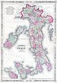
 1864 Johnson Map of Italy - Geographicus - Italy-johnson-1864.jpg 3,194 × 4,500; 4.3 MB
-
 1864 Johnson Map of the Roman Empire - Geographicus - RomanEmpire-johnson-1864.jpg 4,000 × 2,467; 3.46 MB
-
 1864 Johnson's Map of Italy - Geographicus - Italy-j-64.jpg 2,085 × 3,000; 1.86 MB
-
 1864 Mitchell Map of Ireland and Scotland - Geographicus - IrelandScotland-mitchell-1864.jpg 4,000 × 3,216; 3.03 MB
-

-
 A geography for beginners - DPLA - 25f2e74de5ecf0e41a5329ccbf9af71f (page 90).jpg 2,696 × 2,209; 900 KB
-
 A geography for beginners - DPLA - 25f2e74de5ecf0e41a5329ccbf9af71f (page 94).jpg 1,894 × 3,219; 691 KB
-
 Carte des états désunis d'Europe - Kungliga Biblioteket - 10348540-thumb.png 10,307 × 7,703; 382.93 MB
-

-

-
 Carte routière du département de l'Orne - 1864.jpg 9,084 × 6,105; 9.9 MB
-
 Guido Stache, Istrien geological map - Ausschnitt.jpg 2,411 × 2,642; 753 KB
-
 Map of Isle of Wight and part of Nansemond LOC 2012592117.jpg 6,128 × 10,060; 7.15 MB
-
 Map of Isle of Wight and part of Nansemond LOC 2012592117.tif 6,128 × 10,060; 176.38 MB
-

-
 Portugal1864(distritos+estradas+cf).jpg 1,418 × 838; 343 KB
-
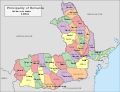 Romania administrative divisions, 1864.svg 1,042 × 801; 400 KB
-
 Sjøkart over Sveriges kyst fra Kosterøyene til Norskegrensen fra 1864.png 4,252 × 2,917; 20.49 MB
-
 Spitzbergen Nordost 1864 Karte.png 1,347 × 1,700; 4.16 MB


.jpg)
.jpg)


.jpg)


