Category:1870 maps of Massachusetts
Jump to navigation
Jump to search
States of the United States: Illinois · Kentucky · Massachusetts · Michigan · Minnesota · New Jersey · New Mexico · New York · Ohio · Pennsylvania · Utah · West Virginia
| ← 1870 1871 1872 1873 1874 1875 1876 1877 1878 1879 → |
Subcategories
This category has the following 2 subcategories, out of 2 total.
B
- 1870 maps of Boston (24 F)
Media in category "1870 maps of Massachusetts"
The following 4 files are in this category, out of 4 total.
-
 Combined map of Holyoke and Chicopee (3886418475).jpg 1,733 × 2,000; 3.06 MB
-
 Map of Winchendon, Massachusetts in 1870.jpg 2,000 × 1,315; 2.74 MB
-
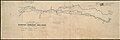
 Plan of Sherburne Bluffs, Nantucket, Mass. (9474974462).jpg 800 × 542; 79 KB
-
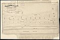
 Plan of the Dighton and Somerset Rail Road, circa 1860s.jpg 9,928 × 3,288; 3.05 MB
.jpg)

.jpg)