Category:1870s maps of the Atlantic Ocean
Jump to navigation
Jump to search
Media in category "1870s maps of the Atlantic Ocean"
The following 22 files are in this category, out of 22 total.
-

-

-

-

-

-
-
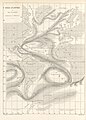
 FMIB 49367 Track of H M S "Porcupine" -- 1876.jpeg 2,112 × 1,608; 1.08 MB
-

-

-
-

-
 Admiralty Chart No 2060a North Atlantic Ocean Eastern portion, Published 1870.jpg 6,289 × 10,735; 24.15 MB
-
 Admiralty Chart No 2060b North Atlantic Ocean Western portion, Published 1870.jpg 11,811 × 14,173; 32.49 MB
-
 Admiralty Chart No 2202a South Atlantic Ocean Eastern portion, Published 1871.jpg 7,963 × 13,890; 34.94 MB
-
 Admiralty Chart No 2202b South Atlantic Ocean Western portion, Published 1871.jpg 7,623 × 13,415; 59.57 MB
-
 Carpenter Porcupine 1870 Plate 4 proceedingsofroy1818roya 0527.jpg 2,508 × 3,540; 730 KB
-
 Carpenter Porcupine 1870 Plate 5 proceedingsofroy1818roya 0531.jpg 3,608 × 3,227; 551 KB
-
 Carpenter Porcupine 1870 Plate 6 proceedingsofroy1818roya 0535.jpg 5,163 × 3,390; 1.02 MB
-
 FMIB 43923 Trade-winds and Monsoons of the Atlantic.jpeg 865 × 702; 188 KB
-
 FMIB 43964 Transatlantic Cables.jpeg 887 × 461; 126 KB
-
 FMIB 43969 Showers of Volcanic Ashes.jpeg 2,147 × 1,545; 776 KB
-
 FMIB 49946 -Atlantic Ocean-.jpeg 1,113 × 701; 255 KB
.jpg)
.jpg)
.jpg)


.jpg)

_(14598194550).jpg)
%27_(11267992386).jpg)
%27_(11257784594).jpg)
%27_(11116221293).jpg)


