Category:1875 United States gubernatorial election maps
Jump to navigation
Jump to search
Media in category "1875 United States gubernatorial election maps"
The following 5 files are in this category, out of 5 total.
-
 1875 Kentucky gubernatorial election results map by county.svg 810 × 357; 83 KB
-
 1875 Minnesota gubernatorial election results map by county.svg 289 × 324; 1.38 MB
-
 1875 Ohio gubernatorial election results map by county.svg 810 × 810; 40 KB
-
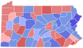 1875 Pennsylvania gubernatorial election results map by county.svg 810 × 471; 50 KB
-
 Ohio archæological and historical quarterly (1887) (14592360810).jpg 1,952 × 2,080; 1.43 MB


_(14592360810).jpg)