Category:1875 maps of Philadelphia
Jump to navigation
Jump to search
Counties of Pennsylvania : Delaware · Philadelphia ·
| 1870 1872 1875 1876 |
Media in category "1875 maps of Philadelphia"
The following 10 files are in this category, out of 10 total.
-
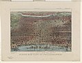
 Bird's eye view, centennial exhibition buildings & grounds, Philad'a LOC 79695383.jpg 8,568 × 5,317; 10.64 MB
-
 Birds eye view of Philadelphia LCCN90711913.jpg 7,226 × 5,580; 8.22 MB
-
 City Atlas of Philadelphia, 2nd to 20th and 29th and 31st Wards, 1875, Plate F.png 3,156 × 1,964; 11.26 MB
-
 Hopkins1875 rittenhouse-map.jpg 700 × 449; 542 KB
-
 Map of the centennial grounds and vicinity, Philadelphia (NYPL b13844876-5247824).tiff 7,760 × 10,328, 2 pages; 229.57 MB
-
 Philadelphia 100 years ago. LOC 2002624000.jpg 7,864 × 5,909; 8.57 MB
-
 Philadelphia 100 years ago. LOC 2002624000.tif 7,864 × 5,909; 132.95 MB
-
 Philadelphia 100 years ago. LOC 2002624003.jpg 7,824 × 6,320; 10.01 MB
-
 Philadelphia 100 years ago. LOC 2002624003.tif 7,824 × 6,320; 141.47 MB
-


_(14735740346).jpg)