Category:1887 maps of California
Jump to navigation
Jump to search
States of the United States: California · Connecticut · Florida · Georgia · Iowa · Kansas · Louisiana · Michigan · Minnesota · Mississippi · Missouri · New Jersey · New York · North Carolina · Ohio · Pennsylvania · South Dakota · Tennessee · Texas · Utah · Virginia · Washington · Wisconsin · Wyoming
| ← 1880 1881 1883 1884 1885 1886 1887 1888 1889 → |
Subcategories
This category has the following 5 subcategories, out of 5 total.
S
Media in category "1887 maps of California"
The following 73 files are in this category, out of 73 total.
-

-

-
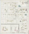
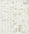
 Sanborn Fire Insurance Map from Alvarado, Alameda County, California. LOC sanborn00381 001.tif 6,450 × 7,650; 141.17 MB
-

-
 Sanborn Fire Insurance Map from Anaheim, Orange County, California. LOC sanborn00384 002-1.tif 6,450 × 7,650; 141.17 MB
-

-
 Sanborn Fire Insurance Map from Anaheim, Orange County, California. LOC sanborn00384 002-2.tif 6,450 × 7,650; 141.17 MB
-

-
 Sanborn Fire Insurance Map from Anaheim, Orange County, California. LOC sanborn00384 002-3.tif 6,450 × 7,650; 141.17 MB
-

-
 Sanborn Fire Insurance Map from Anaheim, Orange County, California. LOC sanborn00384 002-4.tif 6,450 × 7,650; 141.17 MB
-
 Auburn, Cal. LOC 98680675.jpg 8,958 × 6,480; 12.82 MB
-
 Auburn, Cal. LOC 98680675.tif 8,958 × 6,480; 166.08 MB
-
 Bird's eye view of Azusa, Los Angeles Co. Cal., 1887 LOC 2007629036.jpg 8,463 × 6,500; 10.99 MB
-
 Bird's eye view of Azusa, Los Angeles Co. Cal., 1887 LOC 2007629036.tif 8,463 × 6,500; 157.38 MB
-
-
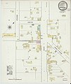
 Sanborn Fire Insurance Map from Centerville, Alameda County, California. LOC sanborn00457 001.tif 6,450 × 7,650; 141.17 MB
-

-

-

-

-

-

-

-

-
 Hittell's hand-book of Pacific Coast travel (1885) (14595337297).jpg 2,568 × 3,048; 884 KB
-
 Lankershim Ranch Land and Water Company 1887.png 4,104 × 6,159; 38.04 MB
-
-
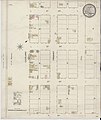
 Sanborn Fire Insurance Map from Oceanside, San Diego County, California. LOC sanborn00731 001.tif 6,450 × 7,650; 141.17 MB
-
 Official map of Siskiyou County, State of California LOC 2012592101.jpg 21,418 × 13,660; 44.42 MB
-

-

-
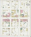
 Sanborn Fire Insurance Map from Pasadena, Los Angeles County, California. LOC sanborn00749 001-1.tif 6,450 × 7,650; 141.17 MB
-

-
 Sanborn Fire Insurance Map from Pasadena, Los Angeles County, California. LOC sanborn00749 001-2.tif 6,450 × 7,650; 141.17 MB
-

-
 Sanborn Fire Insurance Map from Pasadena, Los Angeles County, California. LOC sanborn00749 001-3.tif 6,450 × 7,650; 141.17 MB
-

-
 Sanborn Fire Insurance Map from Pasadena, Los Angeles County, California. LOC sanborn00749 001-4.tif 6,450 × 7,650; 141.17 MB
-

-
 Sanborn Fire Insurance Map from Pasadena, Los Angeles County, California. LOC sanborn00749 001-5.tif 6,450 × 7,650; 141.17 MB
-

-
 Sanborn Fire Insurance Map from Riverside, Riverside County, California. LOC sanborn00793 003-1.tif 6,450 × 7,650; 141.17 MB
-

-
 Sanborn Fire Insurance Map from Riverside, Riverside County, California. LOC sanborn00793 003-2.tif 6,450 × 7,650; 141.17 MB
-

-
 Sanborn Fire Insurance Map from Riverside, Riverside County, California. LOC sanborn00793 003-3.tif 6,450 × 7,650; 141.17 MB
-

-
 Sanborn Fire Insurance Map from Riverside, Riverside County, California. LOC sanborn00793 003-4.tif 6,450 × 7,650; 141.17 MB
-

-
 Sanborn Fire Insurance Map from Riverside, Riverside County, California. LOC sanborn00793 003-5.tif 6,450 × 7,650; 141.17 MB
-

-
 Sanborn Fire Insurance Map from Riverside, Riverside County, California. LOC sanborn00793 003-6.tif 6,450 × 7,650; 141.17 MB
-

-

-
 Sanborn Fire Insurance Map from Orange, Orange County, California. LOC sanborn00736 002.jpg 6,450 × 7,650; 3.35 MB
-
 Sanborn Fire Insurance Map from Orange, Orange County, California. LOC sanborn00736 002.tif 6,450 × 7,650; 141.17 MB
-

-

-

-

-

-
 Sanborn Fire Insurance Map from Santa Ana, Orange County, California. LOC sanborn00830 002-1.tif 6,450 × 7,650; 141.17 MB
-

-
 Sanborn Fire Insurance Map from Santa Ana, Orange County, California. LOC sanborn00830 002-2.tif 6,450 × 7,650; 141.17 MB
-
-
 Sanborn Fire Insurance Map from Santa Ana, Orange County, California. LOC sanborn00830 002-3.tif 6,450 × 7,650; 141.17 MB
-

-
 Sanborn Fire Insurance Map from Santa Ana, Orange County, California. LOC sanborn00830 002-4.tif 6,450 × 7,650; 141.17 MB
-

-
 Sanborn Fire Insurance Map from Sausalito, Marin County, California. LOC sanborn00843 001-1.tif 6,450 × 7,650; 141.17 MB
-

-
 Sanborn Fire Insurance Map from Sausalito, Marin County, California. LOC sanborn00843 001-2.tif 6,450 × 7,650; 141.17 MB
.jpg)


_(14595337297).jpg)


