Category:1888 maps of the Caribbean
Jump to navigation
Jump to search
Subcategories
This category has the following 3 subcategories, out of 3 total.
B
- 1888 maps of the Bahamas (1 F)
- 1888 maps of Barbados (2 F)
S
Media in category "1888 maps of the Caribbean"
The following 3 files are in this category, out of 3 total.
-
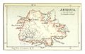 Map of Antigua (1888).jpg 983 × 625; 381 KB
-

-
 Isla de Puerto-Rico.JPG 2,052 × 859; 2.7 MB
.jpg)
.jpg)
