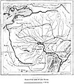
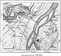
Category:1890 maps of Egypt
Jump to navigation
Jump to search
Media in category "1890 maps of Egypt"
The following 15 files are in this category, out of 15 total.
-
AFR V1 D091 Head of the Ibrahimieh canal.jpg 1,754 × 2,423; 624 KB
-
AFR V1 D093 Entrance of the Fayum.jpg 1,748 × 1,891; 670 KB
-
AFR V1 D094 Fayum.jpg 1,707 × 1,937; 534 KB
-
AFR V1 D393 Density of the population of Egypt.jpg 1,473 × 2,621; 795 KB
-
AFR V1 D404 Chain of Oases west of Egypt.jpg 1,822 × 1,591; 221 KB
-
AFR V1 D407 The Natron lakes.jpg 1,763 × 1,366; 405 KB
-
AFR V1 D415 Isothermal lines and rainfall of Egypt.jpg 1,682 × 2,546; 709 KB
-
AFR V1 D430 Arab tribes in Egypt.jpg 1,830 × 2,487; 468 KB
-
AFR V1 D436 Religions of Egypt.jpg 1,644 × 2,351; 290 KB
-
AFR V1 D456 Lake Timsah.jpg 1,715 × 1,371; 518 KB
-
AFR V1 D461 Assuan and the first cataract before the opening of the railway.jpg 1,781 × 1,912; 675 KB
-
AFR V1 D468 Ruins of Thebes.jpg 1,731 × 1,600; 713 KB
-
AFR V1 D512 Barrage of the Nile.jpg 1,753 × 1,431; 208 KB
-
AFR V1 D515 Entrance of the Wady-Tumilat, Tel-el-Kebir.jpg 1,799 × 1,374; 404 KB
-
AFR V1 D520 The San Morass.jpg 1,796 × 1,019; 288 KB


