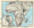
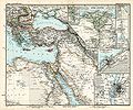
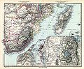
Category:1891 maps of Africa
Jump to navigation
Jump to search
Temperate regions: North America · South America · Africa · Europe · Asia · – Polar regions: – Other regions:
| ← 1890 1891 1892 1893 1894 1895 1896 1897 1898 1899 → |
Subcategories
This category has only the following subcategory.
Media in category "1891 maps of Africa"
The following 92 files are in this category, out of 92 total.
-

-

-
 187 of 'Ten Centuries of European Progress. (With maps.)' (11213284175).jpg 1,333 × 2,167; 703 KB
-
 Liberia in Stielers Handatlas 1891 68.jpg 1,027 × 739; 735 KB
-
 Stielers Handatlas 1891 65.jpg 5,150 × 4,300; 6.41 MB
-
 Stielers Handatlas 1891 66.jpg 5,100 × 4,250; 5.67 MB
-
 Stielers Handatlas 1891 67.jpg 5,100 × 4,250; 6.34 MB
-
 Stielers Handatlas 1891 68.jpg 5,050 × 4,200; 6.3 MB
-
 Stielers Handatlas 1891 69.jpg 5,050 × 4,250; 6.1 MB
-
 Stielers Handatlas 1891 71.jpg 5,150 × 4,250; 6.48 MB
-
-
 27 of 'A la Conquête du Tchad. Avec 29 gravures, etc' (11214134405).jpg 2,368 × 1,630; 769 KB
-

-
 303 of 'A la Conquête du Tchad. Avec 29 gravures, etc' (11209809494).jpg 1,616 × 2,597; 840 KB
-
 306 of 'A la Conquête du Tchad. Avec 29 gravures, etc' (11208346184).jpg 1,584 × 2,555; 687 KB
-

-
 375 of 'Ten Centuries of European Progress. (With maps.)' (11210276236).jpg 2,139 × 2,328; 955 KB
-

-

-

-

-

-

-

-
 84 of '(Longmans' Junior School Geography, etc.)' (11210830364).jpg 2,001 × 2,706; 986 KB
-
 85 of 'Longmans' Junior School Geography, etc' (11197973483).jpg 1,969 × 2,758; 881 KB
-
-

-

-
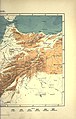
 Abyssinie et Choa - DPLA - 0f3d739f38ac25f55c9c493fba63a23e.jpg 1,000 × 928; 283 KB
-
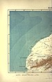
 Admiralty Chart No 664 Africa east coast Zanzibar to Malindi, Published 1891.jpg 8,413 × 12,637; 10.23 MB
-
 AFR V2 D053 Projected railways across West Africa.jpg 1,759 × 2,096; 462 KB
-
 AFR V2 D130 Left side of Tunis and Constantine map in color.jpg 2,333 × 3,607; 1.27 MB
-
 AFR V2 D131 Right side of Tunis and Constantine map in color.jpg 2,432 × 3,781; 958 KB
-
 AFR V2 D246 Left half of Algiers and Oran map in color.jpg 2,534 × 4,004; 1.26 MB
-
 AFR V2 D247 Right half of Algiers and Oran map in color.jpg 2,534 × 4,004; 1,022 KB
-
 AFR V2 D440 Left side of Morocco map in color.jpg 2,534 × 4,004; 997 KB
-
 AFR V2 D441 Right side of Morocco map in color.jpg 2,534 × 3,972; 837 KB
-
 AFR V2 D517 Eastern Sahara.jpg 2,447 × 3,702; 838 KB
-
 AFR V2 D573 Western Sahara.jpg 2,586 × 3,738; 875 KB
-
 AFR V2 D583 Arawan and Mabruk.jpg 1,858 × 1,333; 125 KB
-
 Africa - DPLA - 18a12121c1446b40ba883d215ca4572e.jpg 776 × 1,000; 371 KB
-

-

-

-
 Afrika - DPLA - e3b485a3f2ba6b093ad130015c02c986.jpg 1,000 × 842; 277 KB
-
 Afrika in 6 Blättern, Blatt. 3. - DPLA - fd5f3f653248f5d9316b20d7bc847a20.jpg 1,000 × 844; 286 KB
-
 Afrique - DPLA - 2a8182ee05c9d9f2f4b1970e608afe22.jpg 748 × 1,000; 189 KB
-
 Afrique Meridionale - DPLA - f27ee52f3420b3c418a897f8fb8e5536.jpg 1,000 × 771; 204 KB
-
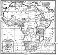
 Afrique Politique - DPLA - f9c52f80310278d347c2a73012cd2914.jpg 1,000 × 781; 178 KB
-
 Afrique Septentrionale - DPLA - 834339afabd669c7835252e8acaff03c.jpg 1,000 × 759; 216 KB
-

-

-

-

-

-

-

-

-

-
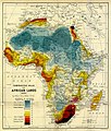 Comparative Value of African Lands - DPLA - 6051ff3655bba4575cae3769d86ce7f4.jpg 850 × 1,000; 388 KB
-
 Die Gartenlaube (1891) b 703.jpg 2,400 × 2,296; 832 KB
-
 Dr W. Junker's Reiseroute durch Bunyoro und Buganda. Januar bis Juni 1886.png 2,250 × 4,252; 11.9 MB
-

-

-
-

-

-

-
 Juta's Map of south Africa, from the Cape to the Zambie... (New edition) - btv1b53027855k.jpg 15,341 × 11,906; 25.52 MB
-
 Map of Algeria, Tunis, and Morocco - DPLA - 4c4a7d108407d6f3244d0c6796a0ad53.jpg 1,000 × 743; 304 KB
-

-
 Part of British Central Africa... - DPLA - 34131ba50f39952fa9de56a4d30f2da9.jpg 1,000 × 535; 186 KB
-
 Possessions portugaises en Afrique méridionale-1891.jpg 620 × 469; 97 KB
-

-

-

-

-

-
-

-

-
 Spezialkarte der Mombassa-Kilimandscharo Route in British-Ostafrika.png 4,485 × 2,567; 15.45 MB
-

-
 Sénégal et Niger - DPLA - c86bf8598bc57b1f62f34787e199367b.jpg 1,000 × 690; 146 KB
-
 Touat - DPLA - 539062b962a2920cde515007d9c5bc43.jpg 1,000 × 892; 313 KB
-
-

-

-

-
 Égypte et Abyssinie - DPLA - ce14359a1a6d626c45a884b312d99188.jpg 736 × 1,000; 205 KB
-
 Égypte, Abyssinie & Arabie - DPLA - 25e88575a5d351b1acdc9d197efc1307.jpg 971 × 1,000; 303 KB
.jpg)
.jpg)
%27_(11213284175).jpg)


.jpg)
.jpg)
.jpg)
.jpg)
.jpg)
%27_(11210276236).jpg)
.jpg)
.jpg)
.jpg)
.jpg)
.jpg)
.jpg)
%27_(11210830364).jpg)
.jpg)
.jpg)
.jpg)
.jpg)


_(14762795342).jpg)


_-_btv1b53029137p.jpg)
_-_Commiss%C3%A3o_de_cartographia_;_gravado..._por_Erhard_F(r%C3%A8)res_35_bis_rue_Denfert-Rochereau,_Paris_-_btv1b7759085v.jpg)


_-_dress%C3%A9_et_dessin%C3%A9_par..._R%C3%A9gnauld_de_Lannoy_de_Bissy_-_btv1b52509868j.jpg)


_-_btv1b84403073.jpg)

_b_703.jpg)


.jpg)
.jpg)
.jpg)
_-_btv1b53027855k.jpg)


_L.P%27_(11208309993).jpg)
_L.P%27_(11208295136).jpg)
_(14576477839).jpg)