Category:1899 maps of South America
Jump to navigation
Jump to search
Temperate regions: North America · South America · Africa · Europe · Asia · Oceania – Polar regions: – Other regions:
| ← 1890 1891 1892 1893 1894 1895 1896 1897 1898 1899 → |
Media in category "1899 maps of South America"
The following 24 files are in this category, out of 24 total.
-
 22 of 'Arnold's Geographical Handbooks' (11251622733).jpg 1,872 × 1,207; 678 KB
-
 23 of 'Arnold's Geographical Handbooks' (11251987193).jpg 1,872 × 1,235; 543 KB
-
 26 of 'Arnold's Geographical Handbooks' (11251952145).jpg 1,872 × 1,207; 570 KB
-
 38 of 'Arnold's Geographical Handbooks' (11288405563).jpg 1,207 × 1,398; 415 KB
-

-

-
 78 of 'Arnold's Geographical Handbooks' (11250319973).jpg 1,920 × 1,310; 744 KB
-
 79 of 'Arnold's Geographical Handbooks' (11251958085).jpg 1,904 × 1,315; 564 KB
-
 82 of 'Arnold's Geographical Handbooks' (11254012543).jpg 1,888 × 1,237; 601 KB
-

-

-
-

-
 94 of 'Arnold's Geographical Handbooks' (11290455913).jpg 1,237 × 1,415; 408 KB
-
 Admiralty Chart No 1306 Plans in Barbara Channel By Captain P.P. King R.N. 1829-30, Published 1899.jpg 16,350 × 11,865; 34.39 MB
-
 Advanced Geography (1899) (14595061178).jpg 2,912 × 3,828; 2.54 MB
-
 Advanced Geography (1899) (14781562882).jpg 2,388 × 3,852; 3.07 MB
-
 Argentine Railways 1899 (Library of Congress, 31.5 MB).jpg 10,624 × 13,917; 31.6 MB
-
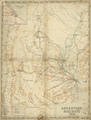 Argentine Railways, 1899 WDL11314.png 997 × 1,314; 2.3 MB
-
 Atlante.mondiale.hoepli.1899.jpg 4,080 × 5,361; 3.2 MB
-

-
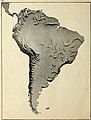
 SouthAmerica1899.JPG 1,222 × 1,678; 800 KB
-
 W.L. Loth - Kaart van Suriname (1899) - Blad A.jpg 5,500 × 3,334; 1.26 MB
-
 W.L. Loth - Kaart van Suriname (1899) - Blad B.jpg 5,500 × 3,312; 821 KB
.jpg)
.jpg)
.jpg)
.jpg)
%27_(11249522474).jpg)
%27_(11249184416).jpg)
.jpg)
.jpg)
.jpg)
.jpg)
.jpg)
.jpg)
.jpg)
.jpg)

_(14595061178).jpg)
_(14781562882).jpg)
.jpg)


_-_ex%C3%A9cut%C3%A9e_par_M._Max.-R._Latrille,_avril_1892_-_btv1b8442021z.jpg)

_-_Blad_A.jpg)
_-_Blad_B.jpg)