Category:18th-century maps of Malaysia
Jump to navigation
Jump to search
Media in category "18th-century maps of Malaysia"
The following 9 files are in this category, out of 9 total.
-
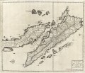
 AMH-6419-NA Map of the Sumatra Strait.jpg 2,400 × 1,435; 766 KB
-
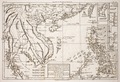
 AMH-6665-KB Two maps of Thailand, Malaysia and Sumatra.jpg 2,400 × 1,846; 1.05 MB
-

-
 Nieuwe kaart van het Eyland Sumatra LOC 2014585053.jpg 7,371 × 6,312; 6.61 MB
-
 Nieuwe kaart van het Eyland Sumatra LOC 2014585053.tif 7,371 × 6,312; 133.11 MB
-
 B26056050B - India orientalis.jpg 5,234 × 4,793; 7.01 MB
-

-
 AMH-5526-NA Map of Sumatra and the Malacca Straits.jpg 1,459 × 2,400; 714 KB
-
 Rigobert-Bonne-Atlas-de-toutes-les-parties-connues-du-globe-terrestre MG 0005.tif 5,238 × 3,576; 53.62 MB


.jpg)


.jpg)
