Category:18th-century maps of New Orleans
Jump to navigation
Jump to search
Subcategories
This category has the following 3 subcategories, out of 3 total.
- 1720s maps of New Orleans (4 F)
- 1760s maps of New Orleans (6 F)
- 1780s maps of New Orleans (1 F)
Media in category "18th-century maps of New Orleans"
The following 27 files are in this category, out of 27 total.
-
 Detalle costa de los alemanes.jpg 2,944 × 1,701; 959 KB
-
 German Coast. Louisiana.jpg 1,506 × 1,387; 568 KB
-
 History and general description of New France (1866) (14782238225).jpg 3,008 × 2,074; 837 KB
-
-

-
 Reducto de Borgoña de la Ciudad de la Nueva Orleans, El Barón de Cordelet.pdf 2,600 × 1,818; 217 KB
-
 Incendio Nueva Orleans 1794.jpg 5,670 × 2,496; 1.62 MB
-

-

-
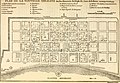
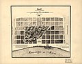
 Map of New Orleans from 18th century.jpg 800 × 600; 121 KB
-
 New orleans 1770 Pittman map.jpg 1,878 × 1,420; 735 KB
-
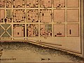
 Neworleansne.jpg 800 × 600; 118 KB
-
 Neworleansnw.jpg 800 × 600; 108 KB
-
 Neworleansse.jpg 800 × 600; 130 KB
-
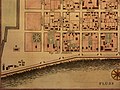 Neworleanssw.jpg 800 × 600; 139 KB
-
 Nouvelle Orleans 1728 map.jpg 1,896 × 1,440; 714 KB
-
 Plan de la Nouvelle Orleans. LOC 2003627002.jpg 3,547 × 2,616; 1.36 MB
-
 Plan des bâtiments de la direction de La Nouvelle-Orléans (1730).png 618 × 612; 459 KB
-

-
 Plan of New Orleans the capital of Louisiana (2673859899).jpg 2,000 × 1,486; 2.87 MB
-
 Plan of New Orleans the capital of Louisiana (4578769207).jpg 4,299 × 3,335; 7.81 MB
-
 Plan of New Orleans the capital of Louisiana LOC 2014589389.jpg 3,651 × 2,975; 1.84 MB
-

-

-

-
-
 Usa-3-8.jpg 2,284 × 1,289; 575 KB


_(14782238225).jpg)


.png)

.jpg)
.jpg)


