Category:18th-century maps of North Africa
Jump to navigation
Jump to search
Subcategories
This category has the following 7 subcategories, out of 7 total.
A
E
L
M
T
Media in category "18th-century maps of North Africa"
The following 28 files are in this category, out of 28 total.
-

-
 1736 Cartagena detail West Part of Barbary map by Herman Moll BPL 14639.png 1,251 × 474; 1.22 MB
-
 1736 Lagos detail West Part of Barbary map by Herman Moll BPL 14639.png 1,251 × 474; 1.22 MB
-
 1736 Malaga detail West Part of Barbary map by Herman Moll BPL 14639.png 1,251 × 474; 1.22 MB
-
 1736 Oran detail West Part of Barbary map by Herman Moll BPL 14639.png 1,245 × 473; 1.21 MB
-
 1736 Palermo detail West Part of Barbary map by Herman Moll BPL 14639.png 1,245 × 473; 1.21 MB
-
 1736 Tripoli detail East Part of Barbary map by Herman Moll BPL 14639.png 1,260 × 464; 1.11 MB
-
 Rigobert-Bonne-Atlas-de-toutes-les-parties-connues-du-globe-terrestre MG 0024.tif 5,334 × 3,618; 55.25 MB
-
 A history of the late siege of Gibraltar Fleuron T134653-1.png 3,895 × 1,184; 69 KB
-
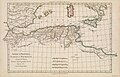
 Africa - DPLA - 296f0b622a296ef9db2cd5ba5fed5549.jpg 1,000 × 687; 173 KB
-
-

-

-
-
 Costes de Barbarie contenant les royaumes d'Alger et de Tunis - (Bellin) - btv1b8595344j.jpg 7,904 × 5,150; 5.65 MB
-

-

-

-

-

-

-

-

-

-

-

-

-


_Armada..._-_btv1b5966449s.jpg)

_-_btv1b8595344j.jpg)
.jpg)
.jpg)
.jpg)
.jpg)
.jpg)


