Category:18th-century maps of Valletta
Jump to navigation
Jump to search
Media in category "18th-century maps of Valletta"
The following 9 files are in this category, out of 9 total.
-

-
 Valletta ou Valete ville forte, de l'isle de Malta. Amsterdam 1705.jpg 3,452 × 2,932; 1.29 MB
-

-
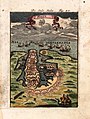
 Valetta Civitas Nova Maltae olim Millitae. Leiden 1712.jpg 943 × 768; 209 KB
-
 Alain Manesson Mallet, Die Stadt Malta.jpg 1,649 × 2,187; 1.52 MB
-
 Les Villes, Forts et Chateaux de Malte. 1724 (BM 1874,0613.1907).jpg 2,500 × 1,774; 1.39 MB
-

-

-

_Les_Forces_de_l%27Europe,_Asie,_Afrique_et_Amerique,_ou_description_des_principales_villes_a,_RP-P-OB-83.034-154.jpg)

.jpg)


.jpg)
_(14780274072).jpg)
_Les_Forces_de_l%27Europe,_Asie,_Afrique_et_Amerique_Comme_aussi_les_Cartes_des_C%C3%B4tes_de_France_e,_RP-P-OB-83.036-164.jpg)
.jpg)