Category:18th-century maps of the Western Mediterranean
Jump to navigation
Jump to search
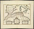
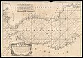
English: This category collects 18th-century maps that show only the Western part of the Mediterranean Sea (between Italy and Spain). This includes (from west to east) the Alboran Sea, the Balearic Sea, the Gulf of Lion, the Ligurian Sea, the Tyrrhenian Sea and the Strait of Sicily
Incomplete maps (like cut-off double pages) should be categorized according to the full content of the original map, unless it is a deliberate crop.
Incomplete maps (like cut-off double pages) should be categorized according to the full content of the original map, unless it is a deliberate crop.
Subcategories
This category has the following 5 subcategories, out of 5 total.
C
- 18th-century maps of Corsica (71 F)
M
- 18th-century maps of Malta (13 F)
S
- 18th-century maps of Sardinia (18 F)
Media in category "18th-century maps of the Western Mediterranean"
The following 22 files are in this category, out of 22 total.
-

-
 Homann.jpg 840 × 709; 520 KB
-
 Carta nautica.jpg 3,500 × 1,242; 912 KB
-
 In notitiam ecclesiasticam Africæ tabula geographica (5960804349).jpg 2,000 × 1,695; 2.9 MB
-

-

-

-
 Arnaud Groignard, Carte de la Mer Mediterranée en trois feuilles 01-west (FL13730800 3366588).jpg 14,601 × 10,553; 209.64 MB
-
-
 A new chart of the Mediterranean Sea 01-west (FL13730729 3368782).jpg 8,585 × 11,602; 120.49 MB
-

-

-
 Joseph Roux, Carte de la Mer Mediterranée (FL13732138 3373905).jpg 13,610 × 9,497; 182.25 MB
-
 Joseph Roux, Carte de la Mer Mediterranée (FL13730740 3369739).jpg 13,578 × 9,590; 180.46 MB
-
 Joseph Roux, Carte de la Mer Mediterranée (FL13732099 3373897).jpg 13,610 × 9,523; 183.01 MB
-
 Joseph Roux, Carte de la Mer Mediterranée (FL13732120 3373892).jpg 9,519 × 13,513; 178.32 MB
-

-

-
 A new chart of the Mediterranean Sea from the best Authorities (BM 1871,1209.92).jpg 2,500 × 1,836; 1.04 MB
-

-

-


.jpg)
.jpg)
_-_btv1b53227041w_(1_of_2).jpg)
.jpg)
.jpg)
.jpg)
.jpg)
_-_Geographicus_-_RegniSicilia-homannheirs-1762.jpg)
..._-_auctor_d%27Anville_Regiae_Humaniorum_Litterarum_Academiae_et..._-_btv1b53119392n_(1_of_2).jpg)
.jpg)
.jpg)
.jpg)
.jpg)


.jpg)
.jpg)
.jpg)
.jpg)