Category:1900 U.S. presidential election maps, county subdivisions
Jump to navigation
Jump to search
Media in category "1900 U.S. presidential election maps, county subdivisions"
The following 20 files are in this category, out of 20 total.
-
 CartogramDemocraticPresidentialCounty1900.png 2,800 × 2,200; 239 KB
-
 CartogramOtherPresidentialCounty1900.png 2,800 × 2,200; 203 KB
-
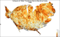
 CartogramPresidentialCounty1900.png 2,800 × 2,200; 243 KB
-
 CartogramPresidentialCounty1900Colorbrewer.png 2,800 × 1,700; 323 KB
-
 CartogramRepublicanPresidentialCounty1900.png 2,800 × 2,200; 238 KB
-
 DemocraticPresidentialCounty1900.gif 2,800 × 2,200; 249 KB
-
 OtherPresidentialCounty1900.gif 2,800 × 2,200; 195 KB
-
 PresidentialCounty1900.gif 2,800 × 2,200; 271 KB
-
 PresidentialCounty1900Colorbrewer.gif 2,800 × 1,700; 225 KB
-
 RepublicanPresidentialCounty1900.gif 2,800 × 2,200; 247 KB
-
 1900 United States presidential election results map by county.svg 555 × 352; 1.34 MB
-
 1900 US Presidential Election in Florida by county.svg 800 × 769; 2.03 MB
-
 1900prescountymap.PNG 1,513 × 983; 190 KB
-
 CartogramDemocraticPresidentialCounty1900Colorbrewer.gif 2,800 × 1,700; 208 KB
-
 CartogramOtherPresidentialCounty1900Colorbrewer.gif 2,800 × 1,700; 219 KB
-
 CartogramRepublicanPresidentialCounty1900Colorbrewer.gif 2,800 × 1,700; 210 KB
-
 DemocraticPresidentialCounty1900Colorbrewer.gif 2,800 × 1,700; 202 KB
-
 OtherPresidentialCounty1900Colorbrewer.gif 2,800 × 1,700; 206 KB
-
 RepublicanPresidentialCounty1900Colorbrewer.gif 2,800 × 1,700; 200 KB
-
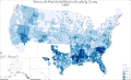
 Votes for Republican President William McKinley 1900.gif 554 × 496; 104 KB


