Category:1900s maps of Argentina
Jump to navigation
Jump to search
Media in category "1900s maps of Argentina"
The following 20 files are in this category, out of 20 total.
-
 Territorio de Magallanes-1895-2.jpg 4,335 × 3,233; 12.48 MB
-
 The new international encyclopaedia (1905) (14801740393).jpg 1,844 × 2,092; 643 KB
-
 Anales del Museo Nacional de Buenos Aires (1895-1911.) (17981105048).jpg 1,848 × 2,722; 607 KB
-
 Brockhaus and Efron Jewish Encyclopedia e3 068-0.jpg 999 × 1,487; 429 KB
-
 Chorotesindiansi00roseiala 0005.jpg 1,196 × 1,360; 618 KB
-

-
 D100- N° 441. Valparaiso et l’Aconcagua. - Liv3-Ch17.png 1,453 × 1,910; 525 KB
-

-
 JUNIN Plano Laguna de Gómez 1904 MHJ 001.jpg 2,929 × 1,448; 626 KB
-
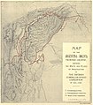
 LA NACION 03 diciembre 1905 Los Andes.jpg 2,304 × 3,072; 1.75 MB
-
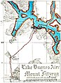 Lake Buenos Aires to Mount Fitzroy.jpg 4,573 × 6,272; 4.62 MB
-
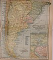
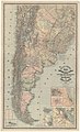
 MAP OF ARGENTINA AND ADJOINING STATES-UK-1900s-PG-40069.jpg 2,707 × 4,000; 1.43 MB
-
 Map of Argentine provinces and municipalities which have issued revenue stamps 1904.jpg 2,581 × 3,494; 1.24 MB
-
 Mapa de la provincia de Cordoba - par Ulrico Greiner... - btv1b53061900t.jpg 8,694 × 13,854; 18.2 MB
-

-
 Mapa de Rosario, Argentina, 1909.png 4,145 × 5,307; 34.14 MB
-
-
-
 P127 - N° 545. Du Bassin de Marañon à celui du Paraná. - Liv4-Ch06.png 1,454 × 1,844; 479 KB
-

_(14801740393).jpg)
_(17981105048).jpg)


_-_publicado_por_Pablo_Ludwig,_1900_-_btv1b53058289m.jpg)


.jpg)


