Category:1908 maps of California
Jump to navigation
Jump to search
States of the United States: Alaska · California · Georgia · Idaho · Illinois · Iowa · Louisiana · Maryland · Massachusetts · Michigan · Minnesota · Missouri · Nebraska · Nevada · New York · North Dakota · Ohio · Pennsylvania · South Dakota · Texas · Utah · Virginia · West Virginia · Wisconsin
| ← 1900 1901 1902 1903 1905 1906 1907 1908 1909 → |
Subcategories
This category has the following 4 subcategories, out of 4 total.
S
Media in category "1908 maps of California"
The following 10 files are in this category, out of 10 total.
-
 Ocean Shore Railroad map.jpg 1,371 × 3,364; 1 MB
-

-

-
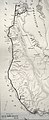
 Mono National Forest map EO 898 illustration.png 1,491 × 1,697; 61 KB
-
 Sanborn Fire Insurance Map from Stent, Tuolomne County, California. LOC sanborn00866 003-1.jpg 8,791 × 10,437; 6.73 MB
-
 Sanborn Fire Insurance Map from Stent, Tuolomne County, California. LOC sanborn00866 003-1.tif 8,791 × 10,437; 262.5 MB
-
 Sanborn Fire Insurance Map from Stent, Tuolomne County, California. LOC sanborn00866 003-2.jpg 8,788 × 10,430; 6.76 MB
-
 Sanborn Fire Insurance Map from Stent, Tuolomne County, California. LOC sanborn00866 003-2.tif 8,788 × 10,430; 262.24 MB
-

-
 Sanborn Fire Insurance Map from Walnut Creek, Contra Costa County, California. LOC sanborn00916 003.tif 8,665 × 10,260; 254.35 MB


