Category:1910 map of the Administration de la Dette Publique Ottomane
Jump to navigation
Jump to search
Media in category "1910 map of the Administration de la Dette Publique Ottomane"
The following 6 files are in this category, out of 6 total.
-
 1910 map of Nazaret de Erzeroum- left page.jpg 9,286 × 12,210; 4.94 MB
-
 1910 map of Nazaret de Erzeroum- right page.jpg 9,286 × 12,551; 5.21 MB
-
 1910 map of Nazaret de Sivas - left page.jpg 9,077 × 12,421; 4.95 MB
-
 1910 map of Nazaret de Sivas - right page.jpg 9,077 × 12,610; 4.59 MB
-
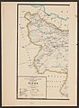
 1910 map of Nazaret de Trebizonde - left page.jpg 11,936 × 9,078; 3.93 MB
-
 1910 map of Nazaret de Trebizonde - right page.jpg 11,936 × 9,424; 4.44 MB


