Category:1910 maps of Russia
Jump to navigation
Jump to search
Countries of Europe: Bulgaria · France‡ · Germany · Lithuania · Norway · Poland · Russia‡ · Spain‡ · Turkey‡ · Ukraine · United Kingdom
‡: partly located in Europe
‡: partly located in Europe
Subcategories
This category has only the following subcategory.
Media in category "1910 maps of Russia"
The following 3 files are in this category, out of 3 total.
-
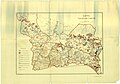 1910. Карта Тобольской губернии.jpg 9,934 × 6,991; 8.33 MB
-
 Russia in empire. LOC 2004629232.jpg 6,928 × 3,790; 3.48 MB
-
 Russia in empire. LOC 2004629232.tif 6,928 × 3,790; 75.12 MB

