Category:1910s maps of France
Jump to navigation
Jump to search
Countries of Europe: Albania · Armenia‡ · Austria · Azerbaijan‡ · Belarus · Belgium · Bosnia and Herzegovina · Bulgaria · Croatia · Cyprus‡ · Czech Republic · Denmark · Finland · France‡ · Georgia‡ · Germany · Greece · Hungary · Iceland · Republic of Ireland · Italy · Lithuania · Luxembourg · Netherlands‡ · Norway · Poland · Portugal‡ · Romania · Russia‡ · Serbia · Slovakia · Slovenia · Spain‡ · Sweden · Switzerland · Turkey‡ · Ukraine · United Kingdom
Limited recognition: Abkhazia‡
‡: partly located in Europe
Limited recognition: Abkhazia‡
‡: partly located in Europe
Subcategories
This category has the following 10 subcategories, out of 10 total.
- 1912 maps of France (34 F)
- 1914 maps of France (26 F)
- 1916 maps of France (12 F)
- 1917 maps of France (4 F)
- 1918 maps of France (9 F)
- 1919 maps of France (14 F)
'
- 1910s maps of Paris (57 F)
T
Media in category "1910s maps of France"
The following 13 files are in this category, out of 13 total.
-
 Plan monumental de Provins - btv1b84453972.jpg 10,398 × 8,038; 10.96 MB
-
 1914 Guerre Européenne 1915. Carte relief no 2, Les Vosges - btv1b10223545n.jpg 6,400 × 5,053; 4.14 MB
-

-

-
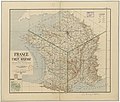
 De LYser a LAisne, Acervo do Museu Paulista da USP.jpg 5,412 × 7,216; 35.23 MB
-
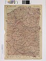
 Vosges (Section Nord). Basse Alsace. Vosges (Section Sud). Haute Alsace - btv1b84461842 (1 of 2).jpg 10,486 × 8,040; 15.07 MB
-
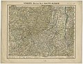 Vosges (Section Nord). Basse Alsace. Vosges (Section Sud). Haute Alsace - btv1b84461842 (2 of 2).jpg 10,510 × 8,061; 14.95 MB
-
 Basel K48 Übersichtskarte von Mitteleuropa 1911 full colour Berkeley C057590503.jpg 6,964 × 5,780; 10.83 MB
-
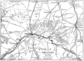 EB1911 - Orleans.png 2,154 × 1,566; 787 KB
-
-
 Map of Lerchenholz - NARA - 140696098.jpg 10,480 × 7,339; 4.45 MB
-
 Mapa.Otto Hauser 2.PNG 551 × 635; 920 KB
-
 Mapa.Otto Hauser.PNG 816 × 856; 1.7 MB


.jpg)
.jpg)

._Basse_Alsace._Vosges_(Section_Sud)._Haute_Alsace_-_btv1b84461842_(1_of_2).jpg)
._Basse_Alsace._Vosges_(Section_Sud)._Haute_Alsace_-_btv1b84461842_(2_of_2).jpg)


_sous_les_auspices_de_l%27a%C3%A9ro-club_Charentais..._-_btv1b84452917.jpg)


