Category:1910s maps of Hesse
Jump to navigation
Jump to search
Federal states of Germany:
Media in category "1910s maps of Hesse"
The following 3 files are in this category, out of 3 total.
-
Mainz - 26-50.jpg 3,278 × 5,007; 3.25 MB
-
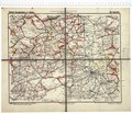
Deutsche Straßenprofilkarte für Radfahrer, Sektion 56 Mainz.tif 3,462 × 3,021; 29.95 MB
-
Karte der Oberförsterei Waldau im Regierungsbezirk Kassel.tif 3,437 × 3,361; 33.34 MB


